NIHSA raises alarm over imminent flood in 17 states
States in Nigeria
Lists Bauchi, Edo, Imo, Kaduna, Plateau, Benue, and 11 additional states
Urges emergency mgt agencies, LG excos, community leaders to enforce safety measures without delay
Emeka Agu Jnr with agency report
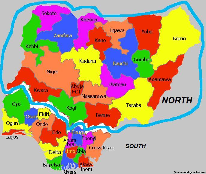
The Nigeria Hydrological Services Agency (NIHSA), on Tuesday, warned that 17 states will face flooding from July 21 to July 27, 2026.
This warning was issued in NiHSA’s National Flood Advisory (Alert No.: NFA-2026-200) forecasting a MEDIUM FLOOD RISK across 17 states.
According to the Director General and Chief Executive Officer, NiHSA, Arc Umar Mohammed, the 17 states include Bauchi, Edo, Imo, Kaduna, Plateau, Benue, and 11 additional states.
In an advisory issued by NIHSA, Director General of NIHSA, Umar Mohammed, said river levels at key stations, including Saminara on the Karam River, Waya Dam Site on the Waya River, and Amber on the Amber River, had exceeded watch and warning water levels and continue to rise at several critical monitoring stations nationwide.
According to him, 16 gauging stations across the national hydrometric network were currently recording elevated river stages, placing communities located along major river channels at risk of imminent localized flooding.
Mohammed therefore urged state governments, local authorities, and residents on floodplains to act immediately without delay.
To reduce the potential impact of the anticipated flooding, the agency directed the National Emergency Management Agency (NEMA), State Emergency Management Agencies (SEMAs), local government authorities, and community leaders to immediately begin evacuating residents, livestock, and valuables from flood-prone areas to designated safe shelters.
Bauchi State has the highest number of vulnerable settlements, with 1,841 communities, alongside 145 schools, 101 health facilities, and eight markets at risk, while in Edo State, 148 communities, 131 schools, 123 health facilities, four markets, seven religious centres and seven hectares of farmland were identified as vulnerable.
For Imo State, the agency projected potential impacts on 415 communities, 423 schools, 198 health facilities, 49 markets, 111 religious centres and 75 hectares of farmland.
The advisory also listed 168 communities, 16 schools, three health facilities, and three religious centres as vulnerable in Kaduna State, while Plateau State could see impacts on 205 communities, 137 schools, 44 health facilities, 16 markets, 81 religious centres and 64 hectares of farmland.
In Benue State, NIHSA identified five communities, eight schools, two health facilities, and four religious centres as areas at risk.
It also called for the pre-positioning of relief materials, including medical supplies, first-aid equipment, water-treatment materials, and food items, while urging communities to activate early-warning volunteers and local communication channels for rapid dissemination of alerts.
NIHSA further advised residents to avoid walking, driving, or riding through flooded roads, bridges, and fast-flowing water, stressing the need to clear blocked drainage systems, culverts, and river channels to improve water flow.
The agency encouraged state governments and the public to monitor its daily flood bulletins and updates for evolving hydrological conditions throughout the advisory period.
Key Highlights of the National Advisory: Affected Jurisdictions: 17 States, including Bauchi, Edo, Imo, Kaduna, Plateau, Benue, and 11 additional states.
Monitoring Stations at Risk: 16 critical gauging stations across the national hydrometric network.
Impact & Exposure Overview: Bauchi State: 1,841 Communities, 145 Schools, 101 Health Facilities, 8 Markets.
Edo State: 148 Communities, 131 Schools, 123 Health Facilities, 4 Markets, 7 Religious Centres, 7 ha of Farmlands.
Imo State: 415 Communities, 423 Schools, 198 Health Facilities, 49 Markets, 111 Religious Centres, 75 ha of Farmlands.
Kaduna State: 168 Communities, 16 Schools, 3 Health Facilities, 3 Religious Centres.
Plateau State: 205 Communities, 137 Schools, 44 Health Facilities, 16 Markets, 81 Religious Centres, 64 ha of Farmlands.
Benue State: 5 Communities, 8 Schools, 2 Health Facilities, 4 Religious Centres.
On directives and recommended actions, the Director General urged emergency management agencies (NEMA/SEMA), local government executives, and community leaders to enforce safety measures without delay: Immediate Evacuation: Move residents, livestock, and critical household valuables away from floodplains to designated safe shelters immediately.
Pre-positioning Relief: Emergency response bodies should pre-position medical, first-aid, water-treatment, and food supplies in safe havens.
Community Mobilisation: Activate early-warning volunteers and local communication channels for rapid alert dissemination.
Public Safety Precautions: Citizens must NOT attempt to walk, drive, or ride through flooded roads, bridges, or fast-flowing water courses.
Drainage Maintenance: Clear blockages in drainage systems, culverts, and river mouths to facilitate unimpeded water flow.